NY42 (Paradise Airport in Red Creek, New York United States) No Parking/Gates!
91NY (Manitou Field in Spencerport, New York United States) No Parking/Gates!
D80 (Olcott-Newfane Airport in Olcott, New York United States) No Parking/Gates!
Click "Copy Link" to copy to your clipboard:

Click button to download a .PLN file of these hops.

Airport Codes:
KFZY-NY42-91NY-D80
STARTING AIRPORT "Oswego County Airport / KFZY"
============
Oswego County Airport (KFZY)
| Automated Surface Observing Systems: | 119.275 Mhz |
| Unicom: | 123.000 Mhz |
| Elevation: | 461 FT |
| Airport Location: | Fulton, New York United States (N43° 21' 2.80",W76° 23' 16.99") [Google Maps] |
| Airport Information: | [Skyvector] [Airnav] |
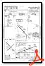
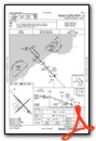
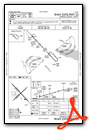
Instrument Approach Procedure (IAP) Charts

Runway Hdg Length       Surface      ILS Name              ILS ID ILS Freq ILS Hdg Open/Closed
06     47  3969 x 87    Asphalt                                                    Open
24     227 3969 x 87    Asphalt                                                    Open
15     137 5165 x 94    Bituminous                                                 Open
33     317 5165 x 94    Bituminous   ILS RW33              IFZY   110.900  317     Open
============
Paradise Airport (NY42)
| Elevation: | 420 FT |
| Airport Location: | Red Creek, New York United States (N43° 13' 12.24",W76° 41' 23.82") [Google Maps] |
| Airport Information: | [Skyvector] [Airnav] |
Runway Hdg Length       Surface      ILS Name              ILS ID ILS Freq ILS Hdg Open/Closed
19     176 2898 x 84    Grass                                                      Open
01     356 2898 x 84    Grass                                                      Open
============
Manitou Field (91NY)
| Elevation: | 470 FT |
| Airport Location: | Spencerport, New York United States (N43° 11' 44.22",W77° 44' 53.02") [Google Maps] |
| Airport Information: | [Skyvector] [Airnav] |
Runway Hdg Length       Surface      ILS Name              ILS ID ILS Freq ILS Hdg Open/Closed
10     91  2867 x 77    Grass                                                      Open
28     271 2867 x 77    Grass                                                      Open
============
Olcott-Newfane Airport (D80)
| Elevation: | 314 FT |
| Airport Location: | Olcott, New York United States (N43° 19' 18.15",W78° 43' 33.07") [Google Maps] |
| Airport Information: | [Skyvector] [Airnav] |
Runway Hdg Length       Surface      ILS Name              ILS ID ILS Freq ILS Hdg Open/Closed
28     272 2258 x 40    Grass                                                      Open
10     92  2258 x 40    Grass                                                      Open
26     249 2364 x 40    Grass                                                      Open
08     69  2364 x 40    Grass                                                      Open
============
Leg 1  - KFZY - NY42 - (15nm)
Leg 2  - NY42 - 91NY - (46nm)
Leg 3  - 91NY - D80  - (43nm)
