KRNM (Ramona Airport in Ramona, California United States)
KNFG (Camp Pendleton MCAS (Munn Field) Airport in Oceanside, California United States)
CA42 (McConville Airstrip in Lake Elsinore, California United States) No Parking/Gates!
KSLI (Los Alamitos Army Air Field in Los Alamitos, California United States)
KWHP (Whiteman Airport in Pacoima, California United States)
KWJF (General William J Fox Airfield in Lancaster, California United States)
7CA2 (Paradise Lakes Airport in Bakersfield, California United States) No Parking/Gates!
KDLO (Delano Municipal Airport in Delano, California United States)
CA69 (Avenal Gliderport in Avenal, California United States)
KKIC (Mesa Del Rey Airport in King City, California United States)
KMRY (Monterey Peninsula Airport in Monterey, California United States)
CL77 (Bonny Doon Village Airport in Santa Cruz, California United States)
Click "Copy Link" to copy to your clipboard:

Click button to download a .PLN file of these hops.

Airport Codes:
KSAN-KRNM-KNFG-CA42-KSLI-KWHP-KWJF-7CA2-KDLO-CA69-KKIC-KMRY-CL77
STARTING AIRPORT "San Diego International Airport / KSAN"
============
San Diego International Airport (KSAN)
| Automatic Terminal Information Service: | 134.800 Mhz |
| Elevation: | 15 FT |
| Airport Location: | San Diego, California United States (N32° 44' 0.80",W117° 11' 22.80") [Google Maps] |
| Airport Information: | [Skyvector] [Airnav] [FlightAware Arrivals] [FlightAware Departures] [FlightPlanDB Arrivals] [FlightPlanDB Departures] |
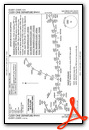
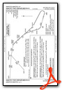
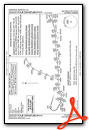
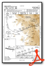
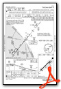
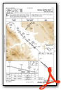
Standard Terminal Arrival (STAR) Charts
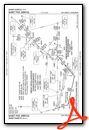
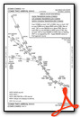
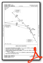

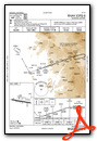
Instrument Approach Procedure (IAP) Charts


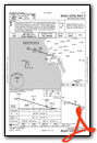

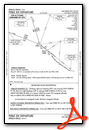
Departure Procedure (DP) Charts


Runway Hdg Length       Surface      ILS Name              ILS ID ILS Freq ILS Hdg Open/Closed
09     106 9397 x 193   Asphalt      ILS RW09              ISAN   111.550  106     Open
27     286 9397 x 193   Asphalt      ILS RW27              IUBR   110.900  286     Open
============
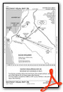
Ramona Airport (KRNM)
| Automatic Terminal Information Service: | 132.025 Mhz |
| Unicom: | 122.950 Mhz |
| Elevation: | 1390 FT |
| Airport Location: | Ramona, California United States (N33° 2' 21.00",W116° 54' 54.91") [Google Maps] |
| Airport Information: | [Skyvector] [Airnav] [FlightAware Arrivals] [FlightAware Departures] [FlightPlanDB Arrivals] [FlightPlanDB Departures] |
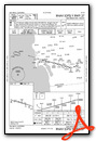
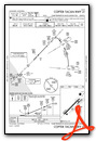
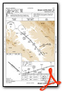
Instrument Approach Procedure (IAP) Charts

Departure Procedure (DP) Charts


Runway Hdg Length       Surface      ILS Name              ILS ID ILS Freq ILS Hdg Open/Closed
09     100 4991 x 139   Asphalt                                                    Open
27     280 4991 x 139   Asphalt                                                    Open
============
Camp Pendleton MCAS (Munn Field) Airport (KNFG)
| Elevation: | 69 FT |
| Airport Location: | Oceanside, California United States (N33° 18' 4.53",W117° 21' 18.62") [Google Maps] |
| Airport Information: | [Skyvector] [Airnav] [FlightAware Arrivals] [FlightAware Departures] [FlightPlanDB Arrivals] [FlightPlanDB Departures] |
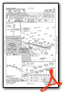
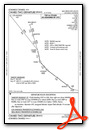
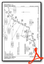
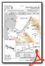
Standard Terminal Arrival (STAR) Charts
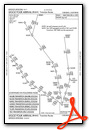
Instrument Approach Procedure (IAP) Charts


Runway Hdg Length       Surface      ILS Name              ILS ID ILS Freq ILS Hdg Open/Closed
03     44  5984 x 188   Asphalt                                                    Open
21     224 5984 x 188   Asphalt                                                    Open
============
McConville Airstrip (CA42)
| Elevation: | 2600 FT |
| Airport Location: | Lake Elsinore, California United States (N33° 38' 37.00",W117° 25' 45.01") [Google Maps] |
| Airport Information: | [Skyvector] [Airnav] [FlightAware Arrivals] [FlightAware Departures] [FlightPlanDB Arrivals] [FlightPlanDB Departures] |
Runway Hdg Length       Surface      ILS Name              ILS ID ILS Freq ILS Hdg Open/Closed
01     21  1471 x 33    Dirt                                                       Open
19     201 1471 x 33    Dirt                                                       Open
============
Los Alamitos Army Air Field (KSLI)
| Automatic Terminal Information Service: | 118.875 Mhz |
| Elevation: | 26 FT |
| Airport Location: | Los Alamitos, California United States (N33° 47' 24.11",W118° 3' 5.12") [Google Maps] |
| Airport Information: | [Skyvector] [Airnav] [FlightAware Arrivals] [FlightAware Departures] [FlightPlanDB Arrivals] [FlightPlanDB Departures] |
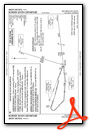
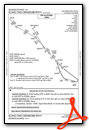
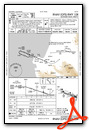
Standard Terminal Arrival (STAR) Charts
Instrument Approach Procedure (IAP) Charts
Departure Procedure (DP) Charts
Runway Hdg Length       Surface      ILS Name              ILS ID ILS Freq ILS Hdg Open/Closed
22R    235 5901 x 148   Asphalt                                                    Open
04L    55  5901 x 148   Asphalt                                                    Open
22L    235 8008 x 195   Asphalt                                                    Open
04R    55  8008 x 195   Asphalt                                                    Open
============
Whiteman Airport (KWHP)
| Automatic Terminal Information Service: | 132.100 Mhz |
| Automated Weather Observing System: | 132.100 Mhz |
| Unicom: | 122.950 Mhz |
| Elevation: | 981 FT |
| Airport Location: | Pacoima, California United States (N34° 15' 33.56",W118° 24' 48.37") [Google Maps] |
| Airport Information: | [Skyvector] [Airnav] [FlightAware Arrivals] [FlightAware Departures] [FlightPlanDB Arrivals] [FlightPlanDB Departures] |
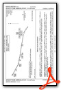
Instrument Approach Procedure (IAP) Charts

Runway Hdg Length       Surface      ILS Name              ILS ID ILS Freq ILS Hdg Open/Closed
12     139 4121 x 75    Asphalt                                                    Open
30     319 4121 x 75    Asphalt                                                    Open
============
General William J Fox Airfield (KWJF)
| Automatic Terminal Information Service: | 126.300 Mhz |
| Unicom: | 122.950 Mhz |
| Elevation: | 2343 FT |
| Airport Location: | Lancaster, California United States (N34° 44' 27.80",W118° 13' 7.09") [Google Maps] |
| Airport Information: | [Skyvector] [Airnav] [FlightAware Arrivals] [FlightAware Departures] [FlightPlanDB Arrivals] [FlightPlanDB Departures] |
Instrument Approach Procedure (IAP) Charts

Runway Hdg Length       Surface      ILS Name              ILS ID ILS Freq ILS Hdg Open/Closed
06     72  7202 x 150   Bituminous                                                 Open
24     252 7202 x 150   Bituminous                                                 Open
============
Paradise Lakes Airport (7CA2)
| Elevation: | 340 FT |
| Airport Location: | Bakersfield, California United States (N35° 10' 36.00",W118° 55' 38.00") [Google Maps] |
| Airport Information: | [Skyvector] [Airnav] [FlightAware Arrivals] [FlightAware Departures] [FlightPlanDB Arrivals] [FlightPlanDB Departures] |
Runway Hdg Length       Surface      ILS Name              ILS ID ILS Freq ILS Hdg Open/Closed
16     178 2617 x 34    Asphalt                                                    Open
34     358 2617 x 34    Asphalt                                                    Open
============
Delano Municipal Airport (KDLO)
| Automated Weather Observing System: | 119.550 Mhz |
| Unicom: | 122.800 Mhz |
| Elevation: | 314 FT |
| Airport Location: | Delano, California United States (N35° 44' 44.00",W119° 14' 11.41") [Google Maps] |
| Airport Information: | [Skyvector] [Airnav] [FlightAware Arrivals] [FlightAware Departures] [FlightPlanDB Arrivals] [FlightPlanDB Departures] |
Instrument Approach Procedure (IAP) Charts

Runway Hdg Length       Surface      ILS Name              ILS ID ILS Freq ILS Hdg Open/Closed
14     159 5654 x 75    Bituminous                                                 Open
32     339 5654 x 75    Bituminous                                                 Open
============
Avenal Gliderport (CA69)
| Elevation: | 775 FT |
| Airport Location: | Avenal, California United States (N36° 0' 10.90",W120° 8' 31.91") [Google Maps] |
| Airport Information: | [Skyvector] [Airnav] [FlightAware Arrivals] [FlightAware Departures] [FlightPlanDB Arrivals] [FlightPlanDB Departures] |
Runway Hdg Length       Surface      ILS Name              ILS ID ILS Freq ILS Hdg Open/Closed
26     270 2413 x 46    Asphalt                                                    Open
08     90  2413 x 46    Asphalt                                                    Open
30     311 3268 x 61    Asphalt                                                    Open
12     131 3268 x 61    Asphalt                                                    Open
============
Mesa Del Rey Airport (KKIC)
| Common Traffic Advisory Frequency: | 122.900 Mhz |
| Elevation: | 372 FT |
| Airport Location: | King City, California United States (N36° 13' 42.79",W121° 7' 16.71") [Google Maps] |
| Airport Information: | [Skyvector] [Airnav] [FlightAware Arrivals] [FlightAware Departures] [FlightPlanDB Arrivals] [FlightPlanDB Departures] |
Instrument Approach Procedure (IAP) Charts
Runway Hdg Length       Surface      ILS Name              ILS ID ILS Freq ILS Hdg Open/Closed
11     131 4475 x 100   Cement                                                     Open
29     311 4475 x 100   Cement                                                     Open
============
Monterey Peninsula Airport (KMRY)
| Automatic Terminal Information Service: | 119.250 Mhz |
| Unicom: | 122.950 Mhz |
| Elevation: | 217 FT |
| Airport Location: | Monterey, California United States (N36° 35' 13.03",W121° 50' 35.03") [Google Maps] |
| Airport Information: | [Skyvector] [Airnav] [FlightAware Arrivals] [FlightAware Departures] [FlightPlanDB Arrivals] [FlightPlanDB Departures] |
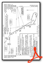
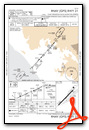
Instrument Approach Procedure (IAP) Charts


Departure Procedure (DP) Charts

Runway Hdg Length       Surface      ILS Name              ILS ID ILS Freq ILS Hdg Open/Closed
10L    113 3495 x 53    Asphalt                                                    Open
28R    293 3495 x 53    Asphalt                                                    Open
10R    113 7166 x 134   Asphalt      ILS RW10R             IMRY   110.700  112     Open
28L    293 7166 x 134   Asphalt      ILS RW28L             IMTB   110.700  292     Open
============
Bonny Doon Village Airport (CL77)
| Elevation: | 2020 FT |
| Airport Location: | Santa Cruz, California United States (N37° 4' 13.81",W122° 7' 38.87") [Google Maps] |
| Airport Information: | [Skyvector] [Airnav] [FlightAware Arrivals] [FlightAware Departures] [FlightPlanDB Arrivals] [FlightPlanDB Departures] |
Runway Hdg Length       Surface      ILS Name              ILS ID ILS Freq ILS Hdg Open/Closed
12     131 2225 x 34    Asphalt                                                    Open
30     311 2225 x 34    Asphalt                                                    Open
============
Leg 1  - KSAN - KRNM - (23nm)    [FlightAware Flights] [FlightAware IFR Analyzer] [FlightPlanDB Routes]
Leg 2  - KRNM - KNFG - (27nm)    [FlightAware Flights] [FlightAware IFR Analyzer] [FlightPlanDB Routes]
Leg 3  - KNFG - CA42 - (21nm)    [FlightAware Flights] [FlightAware IFR Analyzer] [FlightPlanDB Routes]
Leg 4  - CA42 - KSLI - (32nm)    [FlightAware Flights] [FlightAware IFR Analyzer] [FlightPlanDB Routes]
Leg 5  - KSLI - KWHP - (33nm)    [FlightAware Flights] [FlightAware IFR Analyzer] [FlightPlanDB Routes]
Leg 6  - KWHP - KWJF - (30nm)    [FlightAware Flights] [FlightAware IFR Analyzer] [FlightPlanDB Routes]
Leg 7  - KWJF - 7CA2 - (44nm)    [FlightAware Flights] [FlightAware IFR Analyzer] [FlightPlanDB Routes]
Leg 8  - 7CA2 - KDLO - (37nm)    [FlightAware Flights] [FlightAware IFR Analyzer] [FlightPlanDB Routes]
Leg 9  - KDLO - CA69 - (47nm)    [FlightAware Flights] [FlightAware IFR Analyzer] [FlightPlanDB Routes]
Leg 10 - CA69 - KKIC - (49nm)    [FlightAware Flights] [FlightAware IFR Analyzer] [FlightPlanDB Routes]
Leg 11 - KKIC - KMRY - (41nm)    [FlightAware Flights] [FlightAware IFR Analyzer] [FlightPlanDB Routes]
Leg 12 - KMRY - CL77 - (32nm)    [FlightAware Flights] [FlightAware IFR Analyzer] [FlightPlanDB Routes]
